Hi
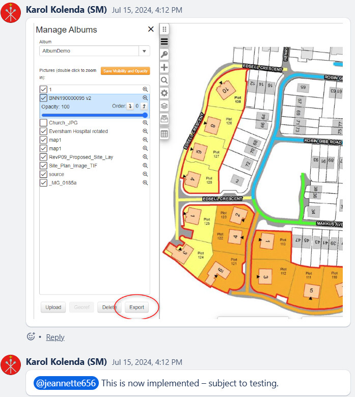
With regard to the above, it would be beneficial that when you have completed georeferencing a plan in Earthlight, that you can then export the plan as a TIFF image or in other formats, as this would then allow for this to then be uploaded to another system i.e. loading a finalised Street Naming and Numbering Plan into Idox Uniform to allow for the new properties to be plotted accurately.
Are there any plans to introduce this functionality?
Thanks
Steven
1 Like
Hello, Steven.
We will have a look at this and I’ll get back to you shortly.
Kind regards,
Gordon
@Steven.Wemyss
Karol has asked if this can be a geopackage instead of TIFF? What 3rd party systems the group is talking about?
Please respond here, and I can update Karol.
cheers
My preference would be TIFF, as this would then allow for the TIFF to be uploaded to Idox Uniform.
Thanks
@Steven.Wemyss
This has now been implemented and is awaiting testing.
Hi Jeanette
Idox are releasing a new version (v2.1) of UniMap Web which introduces functionality enabling you to temporarily add georeferenced image files to a map.
You can add PNG, GIF or JPEG images – these must be included in a ZIP file with a PGW
world file containing the georeferenced information. The image file, PGW file, and ZIP file
must all have the same file name.
With this in mind, would it be possible for the functionality in Earthlight to be updated so that it allows you to be able to export georeferenced plans as PNG, GIF or JPEG images in a zip file with a PGW world file containing the georeferenced information so that the zipfile can then be uploaded to Uniform?
Thanks
Steven
Hello, Steven.
Yes, that is being added and will be available by way of an update to Earthlight.
Kind regards,
Gordon
Hi Gordon
Thanks for the update.
Do you have any timescales for when this will be added to Earthlight?
Steven